This is a clone of the Open User Map WordPress plugin by By 100plugins. All credit goes to 100plugins and other Open Source contributors.
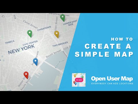
Create a custom map featuring your own locations or an interactive map where anyone can add location pins without registering. New locations will wait for your approval before getting published.
The map is based on Leaflet Map JS and offers you many free map and marker styles. You do not need an API Key, Access Token or any other external registration (like Google). Additionally you have access to awesome MapBox map styles.
Demos | Start 7-day PRO trial (no credit card required) | More Info
Integrate a customized and clear map showcasing only your own location markers, without the option for other users to add new locations. Additional features will be deactivated by default.
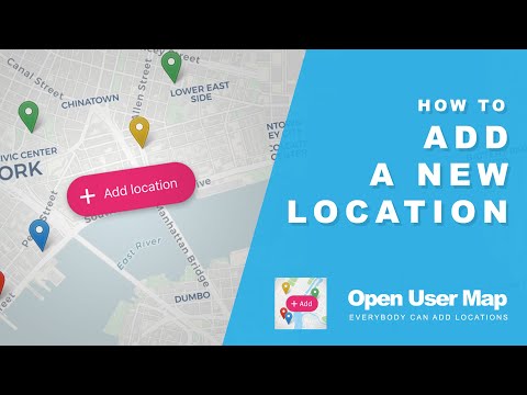
Create a community map! Visitors to your page can add new location markers to the map. You will receive a notification to approve each location before it is published. Your visitors can search for addresses or markers worldwide to quickly find the right spots. You can add custom fields and descriptions to the form to collect the data you need. Image and audio uploads are possible and much more. Let your users collaborate!
Just by clicking a "+"-Button a form will popup to let the visitor enter location details the same comfortable way you can do it in the backend. After submit the location proposal will be "pending" and wait for your review approval to get published.
Add regional navigation tabs and let your visitors 'fly' back and forth between locations that are far apart from each other. See the Demo Map.

Use the Gutenberg Block or Elementor Widget to integrate your map or place the shortcode anywhere on your site. Close by locations will group together in clusters. Make use of Custom Fields to create the form accoding to your needs.
- frontend adding (can be disabled)
- admin approval for pending locations
- based on Leaflet
- no API Keys
- multiple map styles (including MapBox)
- GDPR ready map tiles (Server in Germany)
- multiple marker styles
- Regions as tabs 🆕
- full width map size
- keep map focus in fixed position (stay in an area)
- scroll wheel zoom (optional) 🆕
- Search for Markers 🆕
- Search for Address (OSM geosearch)
- locations with custom fields! 🥳
- private custom fields
- conditional fields (🪄 experimental, please see Help section)
- "subtitle", "description", "image", "audio" and even "title" fields can be disabled
- "subtitle"-field links to google route
- every text bit can be customized
- locations with images & audio
- Shortcode with with custom settings
- Gutenberg Block with custom settings
- Elementor Widget with custom settings
- marker clustering
- fullscreen option
- refresh, redirection or thank you message after submit
- use URL-Parameter &markerid=123 to highlight a specific marker on the map
- get a specific value from a location by using the PHP function oum_get_location_value( 'YOUR VALUE', $post_id )
- use WordPress Hooks to extend the plugin functionality with your own code